Using a Geographic Point field in a form allows you to geolocate households, schools, clinics, or other facilities using a mobile device.
This article explains how the geographic location is captured, and how to ensure you capture the geographic location with the level of accuracy you require.
Understanding geolocation
During data entry, the collector can tap the "Use current location" button to capture and record their current location. ActivityInfo in turn relies on a user's mobile phone or laptop to estimate the user's current location. Their device in turn relies on a number of different sources of location information.
The most accurate source is the Global Positioning System (GPS), a network of satellites orbiting the earth that transmit radio signals mobile phones can use to triangulate the user's current location.
GPS can pinpoint your location to within a few meters, but requires a clear view of the sky. This means that it often doesn't work indoors, or if there is heavy cloud cover. Even if you are outside, surrounding buildings may interfere with GPS signals.
For this reason, most devices can also use other sources to approximate your location if GPS is not available.
The next best source is nearby Wi-Fi networks and cell towers. Using third-party databases of the geographic locations of billions of Wi-Fi access points and cell towers, your phone or laptop can estimate its location to within 15-25 meters.
If neither of these sources are available, your device may fall back to using your network address (your "IP Address"). Since many people using the same Internet Service Provider (ISP) or mobile network carrier share the same IP Address, this is not a very accurate source of location, but may give a rough location within your city or region.
Setting required accuracy levels
For some use cases, you may need to collect very accurate location data.
For example, if you are conducting a survey of water points, you may require an accuracy of 3-5m so that future surveyors can re-locate the surveyed water points. Requiring this level of accuracy may require more time during data collection as surveyors will need to wait for an accurate GPS signal, and it may cause delays if weather conditions make accurate GPS readings impossible.
For other applications, such as mapping villages or school buildings, an accuracy of 25m serves the purpose perfectly well, and you would not want to slow down data collection by requiring more detail.
For these reasons, you can select the accuracy level you require during data collection in the form designer:
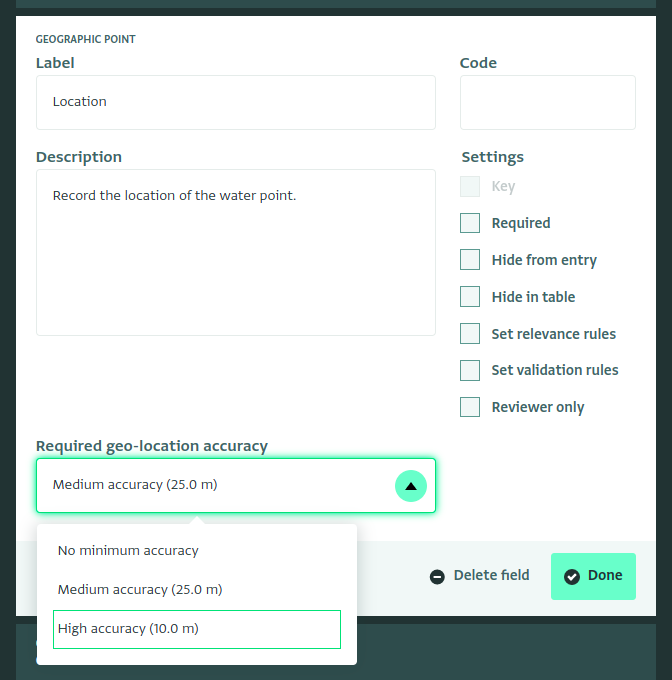
The drop down provides a few suggestions, but you can also enter a specific number of meters.
When collecting data, if the location reading does not meet the required accuracy, the user will be prompted to retry and the coordinates will not be recorded.
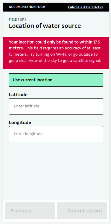
Be careful not to set the accuracy limit too strict. Setting the required accuracy to ten meters or below means that a GPS signal will be required, which will require the user to go outdoors. Data collection may be difficult in areas with many buildings or in overcast weather.
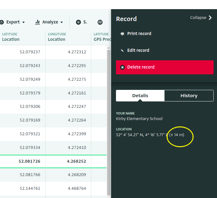
Recording accuracy
When a Geographic Point is collected using the "Use my location" button, the accuracy in meters of the reading is saved along with the latitude and longitude. The accuracy cannot be edited, and if the coordinates are manually edited, the accuracy value will be cleared. Accuracy values can also not be imported.
At this time, the accuracy values cannot be exported or included in the table or in reports. The accuracy can be found
in the record detail panel: