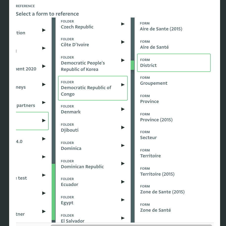
Collect harmonized data based on a common geographic reference
We provide and maintain as a service a common, built-in geographic database for all countries that includes all official administrative levels, from Provinces or Governorates down to Aires de Santé, villages or requested locations.
Ensure quality in geo data
Ensure the data collected for specific locations will always be harmonized. Avoid duplicates or outdated lists of geographic locations or mistakes due to typos and misspelled words.
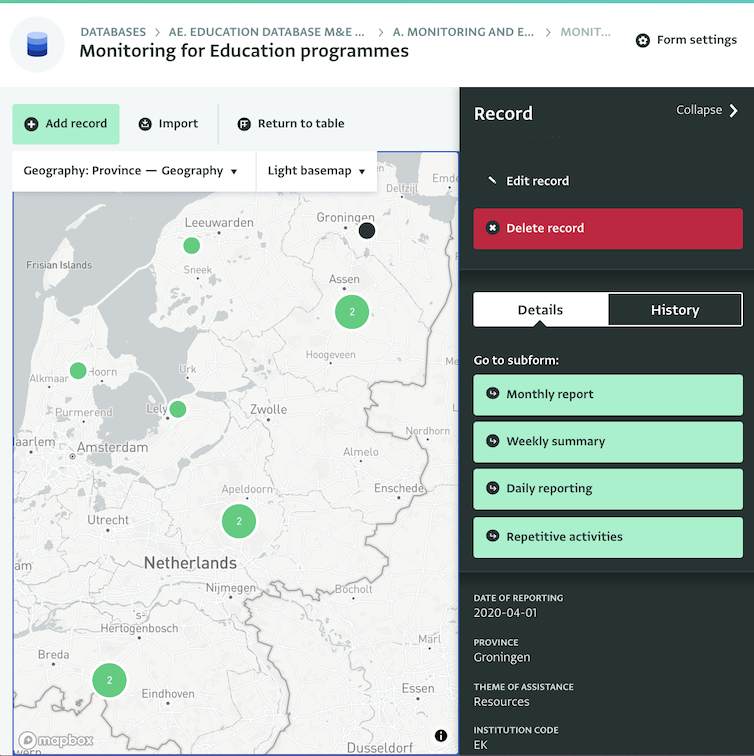
Quickly display and compare data using maps
Display data on maps and ensure that data across your organization can be effortlessly compared geographically thanks to a common geographic reference database.
Cascading lists
Create cascading lists to guide users entering data for locations from the highest to the lowest administrative level.
Global database
Quickly access a global geographic database including all countries and collect data for offices around the world.
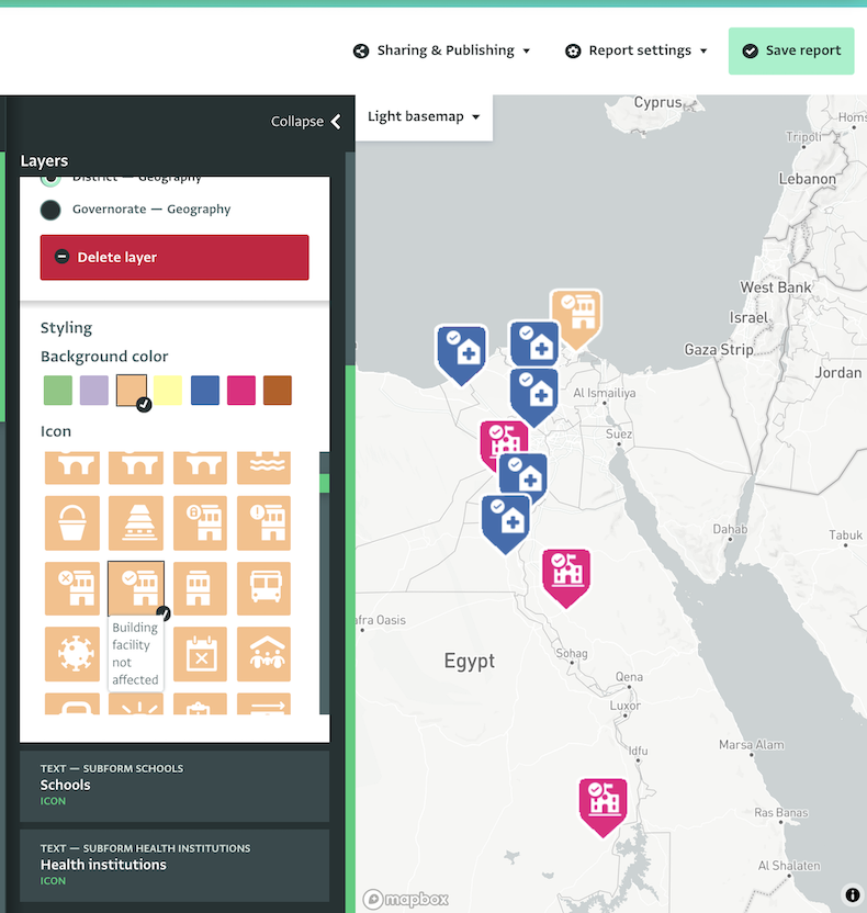
Mapping for everyone!
ActivityInfo's powerful mapping tool gives everyone access to the benefits of a sophisticated Geographic Information System, without the need for extensive training.